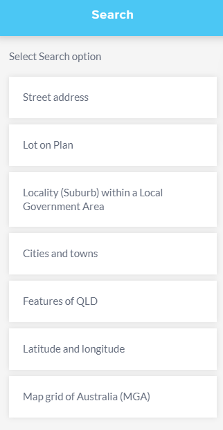
Search
The Search tool provides various search methods to help you locate a specific area of interest on the map. To initiate a search, follow these steps:
- Choose a search method or option that suits your needs from the available choices.
- Input your search term into the designated search field.
- Click on the search icon (represented as a magnifying glass or similar symbol) to start the search process.
- After conducting the search, you will receive a list of search results relevant to your query.
- If you wish to focus on a specific search result on the map, click on that result. This action will zoom the map to the location associated with the selected search result.
By following these steps, you can effectively use the Search tool to find specific places or points of interest on the map and either save them for future use or zoom in on them for immediate reference.
Search options
After the Search tool has been selected from the sidebar, the Search panel will display the search options available for use. The Search panel can be collapsed by selecting the < arrow.
Street address
Search by street address will search through Queensland's primary source of address information and can be used to validate addresses.
The address will be identified on the map by a blue circle. If the search result falls outside of the current map view, the location of the result can be zoomed to by clicking on the result in the Search panel and added as a place for future use if required. To re-centre the search result on the map click on the result in the Search panel.
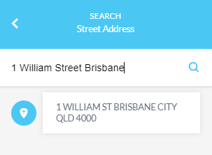
Note: If adjusting the zoom level or using the pan tool, the blue circle will still display but it may move away from the centre of the map view.
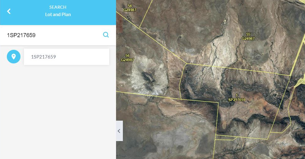
Lot on plan
Searching by lot on plan will reference Queensland's primary source of property information returning the property boundary location on the map (1SP217659 in this example).
The Lot on Plan search option has been enhanced to also include the option to search by BUP lot on plan reference (4105SP140666 in this example).
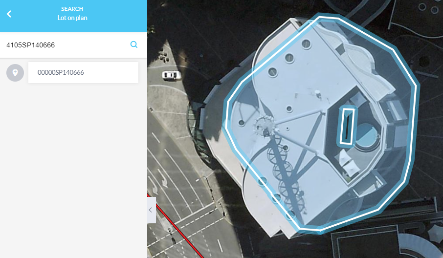
BUP - Building Unit Parcel Building format plan encompasses building unit and group title developments. These plans may be prefixed by a ‘BUP’, ‘GTP’, ‘RP’ or ‘SP’.
Clicking the plus icon will add the lot and plan number to places for future use.
A building format plan (for multi-level units) emerges from the vertical and/or horizontal subdivision of land into lots for individual ownership. Single-level building format plans will have their ‘common property’ and ‘building footprint’ shown in the database as a base parcel record. Multi-level building format plans can have their ‘common property’ and ‘building footprint’ shown in the database as either a base or strata parcel record. The individual lots that make up the multi-level building format plan will be recorded as attribute information against the footprint parcel. Therefore, these individual lots do not have their own “shape” record and should not be assumed to be represented by the shape of the building footprint parcel.
However, if part of a multi-level building format plan is further subdivided, the subsequent building format plan will be shown as a strata parcel record. In this case, each created lot will have its own shape record, and the original lot is removed from the attribute record.
Please be aware the footprint lot is described as Lot 00000 and the Common Property is Lot 0, but neither of these numbers have any significance with the Title. They are only used as attributes to describe the parcels in the Spatial Cadastre dataset/database.
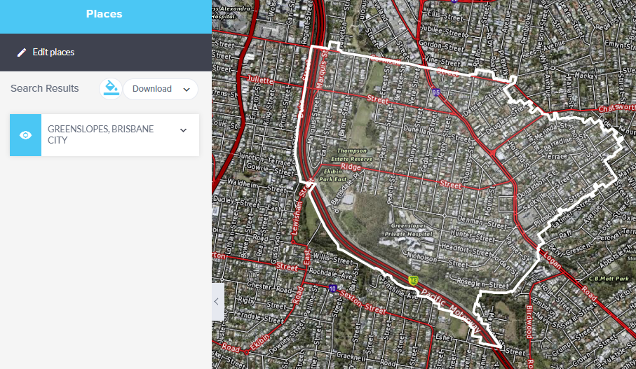
Locality (Suburb) within a Local Government Area
Search by a locality or suburb within a Local Government Area (LGAs) will search through locality and location maps of LGAs and the boundary will highlight on the map (Greenslopes in this example).
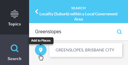
Enter a valid suburb into the search box, the dataset shows list of suburbs and provide predictive suburb suggestion and the LGA’s they fall within; you may then select the correct option by hovering over and clicking on it will zoom the map to the locality.
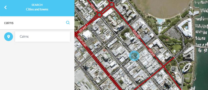
Cities and towns
Search by cities and towns contains point features representing the centre of named urban settlements (populated places) that have been sourced from the Queensland Place Names Database (Cairns in this example).
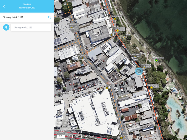
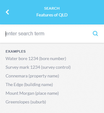
Features of Qld
The Features of Queensland search option has been updated to incorporate the new Queensland Composite Locator service. This service consolidates multiple authoritative Queensland Government spatial datasets into a single search experience and returns ranked, context-rich spatial results. With this update, you should note the following requirements and enhancements for a successful search:
Survey Mark Searches: Users need to enter Survey mark followed by the ID number. For example, to search for a survey mark with the ID number 12345, you should enter: Survey mark 12345.
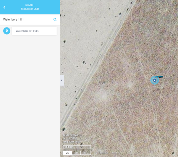
Water Bore Searches: Users need to enter Water bore followed by the ID number. For example, to search for a water bore with the ID number 67890, you should enter: Water bore 67890.
Property Identification Number (PID) Searches: The PID search has been reinstated and is available via the Features of Queensland search. Users can search using PID 12345678, Property ID 12345678, or simply enter the numeric PID (e.g. 12345678). Where a PID represents multiple lots, a single consolidated result is returned for the property, including contextual information such as property name (if applicable), lot/plan summary, street and locality, local government area and postcode.
These specific prefixes (such as Survey mark, Water bore, or PID) help ensure the search query is processed correctly by the Queensland Composite Locator service.
The Features of Queensland search in QLD Globe is powered by the Queensland Composite Locator service. This service consolidates multiple authoritative Queensland Government spatial datasets into a single search experience, returning relevant spatial results with contextual information to help users identify the correct feature.
The search supports a wide range of feature types including Survey marks, Water bores, Property Identification Numbers (PID), Lot/Plan references (e.g. 1RP123456), SegPar identifiers, property names, building names, gazetted place names, suburbs and localities, streets, islands, water monitoring stations, rural properties, physical infrastructure areas, and single house addresses.
Search results are ranked by relevance, displayed with contextual details, linked to the corresponding spatial feature in QLD Globe, and automatically zoom to the correct location upon selection. Where multiple features share the same name, additional contextual attributes are included to help differentiate between them.
The locator is refreshed daily to reflect updates in source systems and supports features within Queensland only.
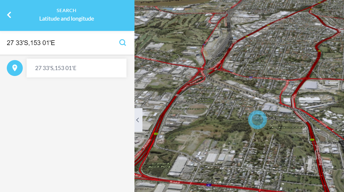
Latitude and longitude
If you have access to coordinate reference points you can search by entering longitude and latitude coordinates in decimal degress or degrees/minutes/seconds (DMS) values (27 33'S,153 01'E in this example). Entering the coordinate value and selecting the search icon will zoom to that location and it will be identified on the map by a blue circle.
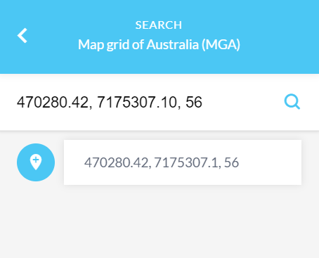
Map Grid of Australia (MGA)
If you have access to coordinate reference points you can also search by entering Map Grid of Australia (470280.42, 7175307.10, 56 in this example). An Easting, Northing and Zone value are required.
For more information on the available search options within Queensland Globe to define you area of interest, please refer to the video tutorial Adding and searching.
What is Geocoding?
Geocoding is the process of turning a description of a location, such as its physical address, into a precise location on a map, namely, a pair of coordinates.
The Queensland Geocoder is available for use and can be accessed here.